National Geographic Ba X Ter St Prk/Mt Katahdin #754 - Educational Map and Guide
- Regular price
-
$14.95 - Regular price
-
$14.95 - Sale price
-
$14.95
SKU: 749717011687 UPC: 749717011687
Couldn't load pickup availability
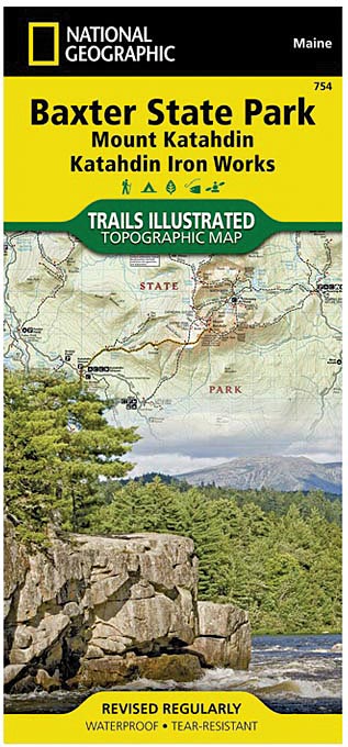
Governor Percival P. Baxter So Enjoyed Vacationing In The Maine Woods As A Child, He Purchased Nearly 6,000 Acres Of Land In 1930 To Fulfill His Dream Of Creating A Park. The Park That Bears His Name Now Covers 209,501 Acres And Includes Mount Katahdin, Maine’s Highest Peak. National Geographic’s Trails Illustrated Map Of Baxter State Park Combines Unmatched Detail With Helpful Information To Offer An Invaluable Tool For Making The Most Of Your Visit. Expertly Researched And Created In Partnership With Local Land Management Agencies, This Map Features Key Points Of Interest Including Katahdin Iron Works, Borestone Mountain, Trout Brook Farm, And South Branch Pond.
The Map Base Includes Contour Lines And Elevations For Summits, Passes And Many Lakes. Some Of The Recreation Features Noted Include Campgrounds, Trailheads, Interpretive Trails, Picnic Areas, Rental Cabins, Boating Access, And Canoe Carry Down Points.
Other Features Found On This Map Include: Mount Katahdin, Pemadumcook Lake, Sebec Lake, Traveler Mountain, White Cap Mountain.
Explore the stunning landscapes of Mount Katahdin and Baxter State Park with the National Geographic Ba X Ter St Prk/Mt Katahdin #754. This detailed map provides comprehensive geographic information, highlighting key trails, landmarks, and natural features to enhance your outdoor adventures. Crafted with high-quality materials, it offers durability and clarity for both planning and navigation purposes. Whether you're an avid hiker or a casual visitor, this guide is an essential resource for exploring the rugged beauty of Maine's premier wilderness area.
The map's features include detailed topographic lines that illustrate elevation changes, making it easier to understand terrain difficulty. It also highlights points of interest such as scenic viewpoints, camping sites, and trailheads, ensuring you can plan your route effectively. Designed for ease of use, the map is compact and lightweight, making it convenient to carry on your outdoor excursions. It is an ideal companion for outdoor enthusiasts seeking to maximize their experience in Baxter State Park and Mount Katahdin.
With the trusted quality associated with National Geographic, this map offers clear, accurate cartography combined with durable construction suitable for outdoor use. Whether you're preparing for a multi-day trek or a day hike, the Ba X Ter St Prk/Mt Katahdin #754 map ensures you have reliable geographic information at your fingertips, helping you navigate safely through one of Maine's most iconic natural areas.
Features:
- Detailed topographic lines highlight elevation changes and terrain features
- Points of interest such as scenic viewpoints, trailheads, and camping sites
- Compact and lightweight design for easy portability
- High-quality, durable material suitable for outdoor use
- Trusted National Geographic cartography for accuracy and clarity
🚚 Shipping & Fulfillment
Over 30,000 at Lotz Outdoors ship the same day when ordered
by 2pm EST, so you can get your gear quickly for your next adventure.
Some products are fulfilled directly from our trusted third-party partners. As a result, these items may:
• Ship separately from other items in your order
• Have different shipping rates
• Not be eligible for free shipping promotions
We work hard to keep shipping fast, reliable, and transparent across our entire catalog, and any differences will be clearly shown at checkout.
⚠️ Shipping restrictions
Shipping restrictions apply to certain products. By purchasing, you confirm compliance with all local, state, and federal laws.
⚠️ California Proposition 65 Warning
⚠️ WARNING: This product may contain chemicals known to the State of California to cause cancer and birth defects or other reproductive harm.
This may include but is not limited to:
- Lead and lead compounds
- Nickel and nickel compounds
- Phthalates (DEHP, DBP, BBP, etc.)
- Bisphenol A (BPA)
- Cadmium and cadmium compounds
For more information go to www.P65Warnings.ca.gov
Discount available for Military, First Responders, Medical Workers and Teachers